 On a very hot day September 8th, 2007 I decided I would take a drive to Tortilla Flat. My friend had brought me there once before and I knew that I wanted to photograph the Superstition Saloon for this book. I had lived in Apache Junction while in the Air Force and had been to Canyon Lake a number of times but had never made it any further than the lake. Stopping along the way and taking pictures of the landscape in this area was fulfilling. I really love this area and have always been amazed by the desert. Driving past the Superstition Mountains made me think about how many prospectors ventured up there looking for gold and never making it back home.
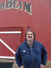
 Canyon Lake is a beautiful lake nestled in the Salt River Canyon which completely surrounds it. I have spent a whole day on the lake with my friend Bryan and had taken my son when he was younger. There is a nice restaurant there with a patio overlooking the lake and there is even a steamboat called the Dolly Steamboat at Canyon Lake. The steamboat takes you on a 90 minute tour or “nature cruise” all around Canyon Lake. So as much as I wanted to stick around the lake and take a lot of pictures, my plan was to get to Tortilla Flat before a big lunch crowd would make getting some shots inside the Superstition Saloon impossible. Now, I had lived in Arizona for a long time but when my bartender asked me if I was going to take in a drive of the Apache Trail, I didn’t know what to say. I had no plans to, never had done it before and had a lot of time after photographing the saloon and decided why not? She told me that the paved road would end soon and I asked if it was wise for me to drive the trail in my little Mitsubishi Eclipse? She told me it would be no problem. I thanked her and headed out on a pretty incredible adventure. I really had no idea what I was in for or what was ahead of me but I was willing.
 The Apache Trail officially begins in Apache Junction, right at the intersection of State Highway 88 and State Highway 60. Highway 88 veers left and you continue past the Superstition Mountains. What I didn’t realize was from this point I was about 45 miles from the end of Apache Trail. Once you get to Tortilla Flat, there is about 5 more miles of a 2 lane paved road. Once that ends, you are on an unpaved, one-lane road for the next 30+ miles. If you take the Apache Trail make sure you bring plenty of water and have a good vehicle because cell phone service is nonexistent. I wasn’t prepared but except for the beautiful scenery, it was pretty uneventful and relaxing. I truly believe this is one of the most scenic drives I have ever taken.
  About 10 miles into the drive, you should come across Apache Gap where you have a great view of Four Peaks. Four Peaks stands at 7,000 feet and is the highest of the mountain ranges in the area. From there, you’ll start a small descent around the canyon road to Canyon Lake. When you get to the lake, there are about 5 more miles before you get to Tortilla Flat. Within 5 more miles outside of Tortilla Flat is when the road ends and the adventure begins. At this point, I drive slow and stopped often to take pictures of the spectacular views of the Apache Trail. The whole drive can take anywhere from 4-5 hours from Canyon Lake to Roosevelt, the end of Apache Trail.
 I had a beautiful day, although the temps were at 108 degrees, I felt good. The scenery gets you right down to your soul. There had been some clouds due to the monsoon season (this area only gets an average of 2 weeks of rain a year) and because of it, I got some great shots. I was by myself but it really didn’t matter, I had plenty of scenery to keep me company.
 At about 10 miles outside of Tortilla Flat, I came across a new rest stop with some walking trails to view out over the canyon. From there, the drive onward became very exciting as I drove down the canyon dropping around 1,500 feet within 3 miles! Apache Lake is about 6 miles from this point and it is awesome! I had never been to Apache Lake and after seeing this beautiful body of water in the middle of the desert made me wish I had. It was amazing to say the least and the next time I go, I think I will do something I am not too fond of and camp! It was a relaxing stop and a very busy area. You would be amazed at the size of the trucks carrying huge boats to put in the lake and how they make it around these canyon roads. I was having a hard enough time with the Mitsubishi!

 At this point you are about 18 miles from Roosevelt Dam.
 Right here I was very close to Roosevelt Dam and almost to the end of the Apache Trail. After traveling 35 miles in a matter of 4 hours, I felt that there couldn’t be anything more spectacular than what I had just seen. But I was wrong. Coming up on Roosevelt Dam was cool. The Dam is massive since it supplies water to the lakes and if you research what it took to build the dam, it is impressive. What was great about this was the man-made lake, Roosevelt Lake. It’s funny because you don’t expect to see this much water in the desert. Beautiful views and it just looked like a great place to go and jet ski, picnic and just have a great time. If you have any time at all and you are visiting the Phoenix area, I urge you to take the time to drive Apache Trail. You won’t be disappointed especially if you have never had a chance to experience the desert. I am glad I listened to the bartender at Superstition Saloon because she was right on about this trip!
Shots of Roosevelt Dam.

 Standing on Roosevelt Dam looking out over Roosevelt Lake.

No comments:
Post a Comment